
Core FunctionDENR is tasked to formulate and implement policies, guidelines, rules and regulations relating to environmental management and pollution prevention and control. We formulate, implement and supervise the government's policies, plans and programs pertaining to the management, conservation, development, use and replenishment of the country's natural resources and biological diversity. Further, we promulgate and implement rules and regulations governing the exploration, development, extraction, disposition, and use of our forests, lands, minerals, wildlife and other natural resources. |
MAJOR PROGRAMS/PROJECTS/ ACTIVITIES AND STRATEGIESFORESTRY SECTOR
1. Management of Forestlands and Forest Resources
2. Forest Development
|
|
3. Trees for Life “20M Seedlings for Planting under the Green Philippine Program
2. Mangrove and coastal areas 3. Agroforestry areas 4. Urban park, school campuses, camps and other open areas |
4. Forestland Boundary Delineation and Land Use Allocation
support proclamation by Congress of permanent forest line of the country.
|
LAND SECTOR
1. Land Survey
issuance of titles or patents, land registration purposes and taxation.
- Delineate boundaries of various political subdivision ( barangay, city/municipality, province) as well as boundaries between the forested
areas and the A and D lands.
- Establish correct boundaries between municipalities with conflicts/disputes to provide accurate land area for purposes of Internal
Revenue Allocation (IRA).
2. Establishment/Densification of PRS 92 Geodetic Control Point
3. Public Land Survey
4. Land Management
b) Patent issuance for commercial and industrial uses
c) Management and lease of Foreshore Areas
d) Management and lease of patrimonial properties and other government-owned lands
- Cadastral Survey
issuance of titles or patents, land registration purposes and taxation.
- Delineate boundaries of various political subdivision ( barangay, city/municipality, province) as well as boundaries between the forested
areas and the A and D lands.
- Establish correct boundaries between municipalities with conflicts/disputes to provide accurate land area for purposes of Internal
Revenue Allocation (IRA).
2. Establishment/Densification of PRS 92 Geodetic Control Point
- Control points form the basis of standard reference of all surveys and where all survey should emanate.
- Establish a pair of control points for each barangay
3. Public Land Survey
- Subdivision of A & D lands of the public domain for the purpose of disposition to qualified beneficiaries.
- Original isolated surveys of lands for use in original land registration proceedings known as Property Registration Decree.
4. Land Management
- Land Disposition
b) Patent issuance for commercial and industrial uses
c) Management and lease of Foreshore Areas
d) Management and lease of patrimonial properties and other government-owned lands
- Disposition of Land Cases
PROTECTED AREAS, WILDLIFE AND COASTAL ZONE MANAGEMENT SECTOR
Protected Areas and Wildlife Bureau
|
1. Protected Areas and Wildlife Resources Development
- A multi-stakeholder partnership to develop an area for sustainable tourism where community participation, protection and management of natural resources, culture and indigenous knowledge and practices, environmental education, and ethics and economic benefits are fostered and pursued.
- Operationalize Protected Area Management Board (PAMBs) - Protect/Patrol Protected Areas (PAs) |
2. Biodiversity Conservation
3. Coastal and Marine Resources Management
- Establishment of marine sactuaries - Formation and/or strengthening of Coastal Law Enforcement Alliances (CLEAR) teams - Assessment of coastal areas for investment |
ECOSYSTEM RESEARCH AND DEVELOPMENT SECTOR
1. Technology Generation
2. Technology Transfer and adoption
- Focusing on production of high quality seeds for reforestation, assessment of the carrying capacity of ENR and vulnerability assessment of characterized watersheds, environmental-related and other program geared toward sustainability and enhance productivity of the NR and protection of the environment
2. Technology Transfer and adoption
- Identification of livelihood activities for upland communities and provide technical assistance
ENVIRONMENT SECTOR1. Environment Management and Pollution Control
Particles (TSP) levels and mitigate air pollution
creeks b) Industrial Ecowatch Program – monitor water quality disposal of firms and industries c) Beach Ecowatch Program – Generate water quality information on beaches frequently visited by tourist d) Tapwatch Program – monitor the quality of drinking water in communities/barangay |
ECC 2. Toxic Substance and waste management
- Establish Material Recovery Facilities (MFRs) - Conduct Technical Assistance to LGUs, NGOs and POs. |
MINES SECTOR1. Mineral Land Administration
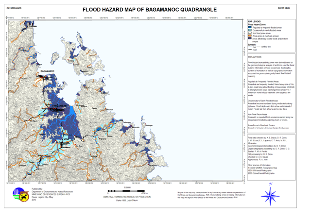
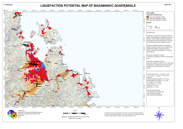
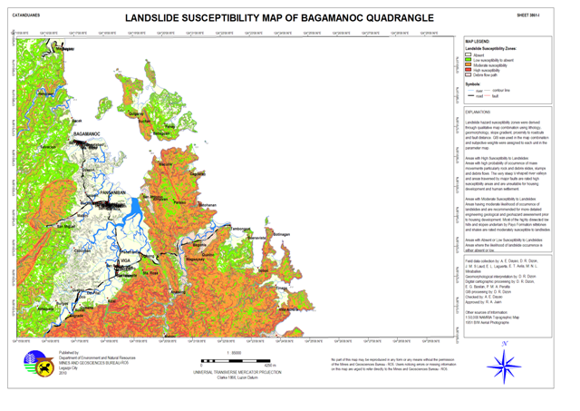
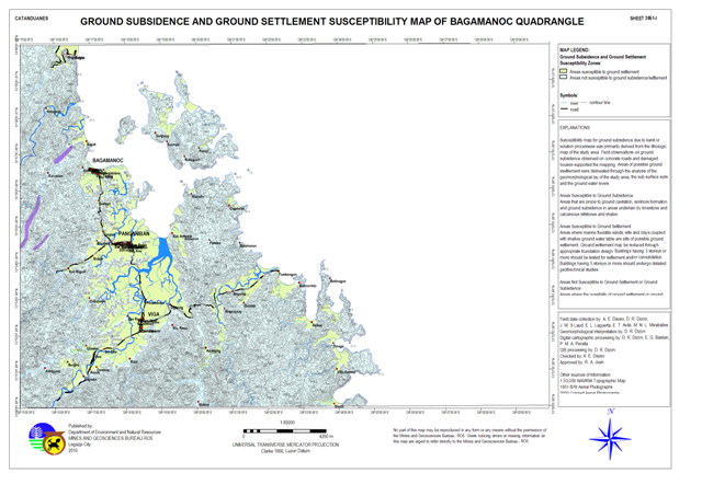
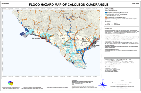
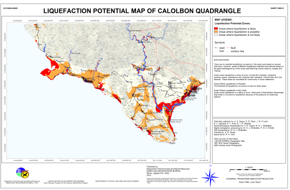
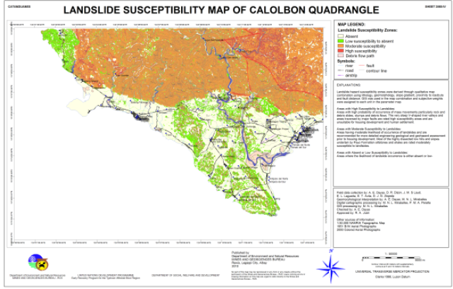
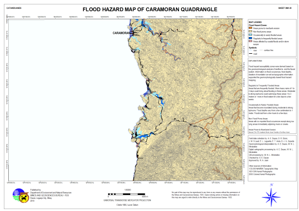
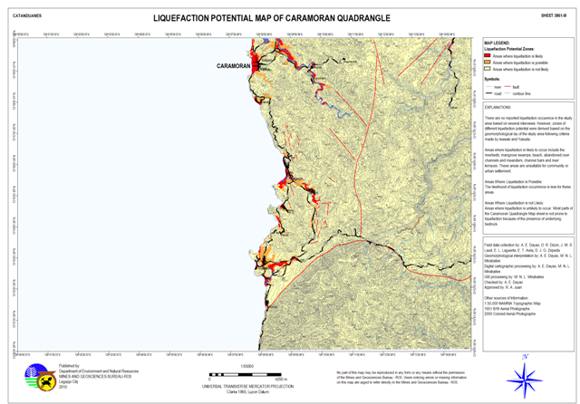
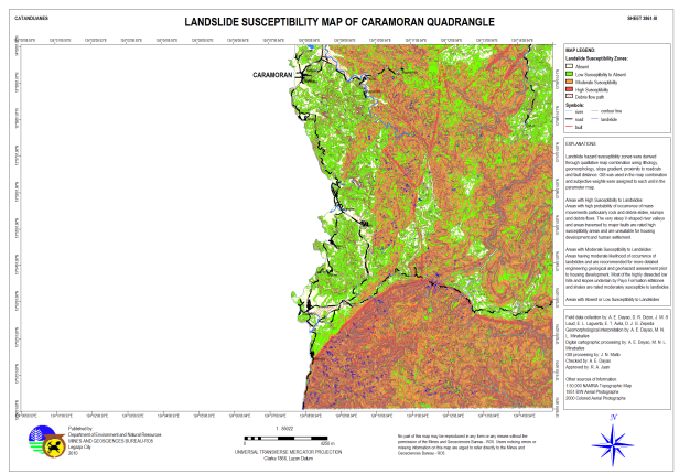
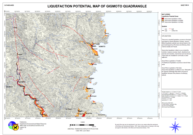
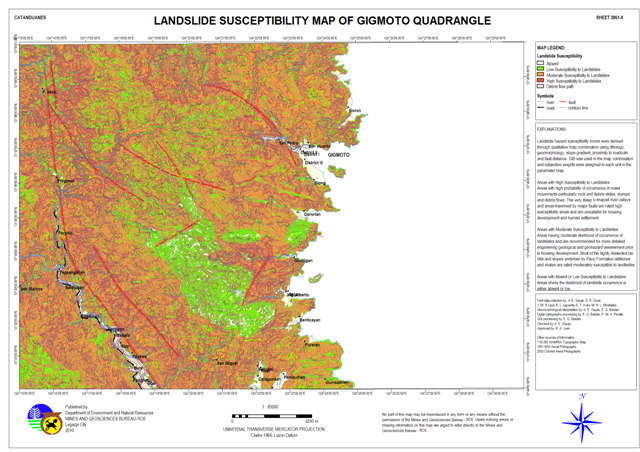
2. Geosciences Development - Geared towards disaster preparedness through geohazards assessment and groundwater resources availability.
|
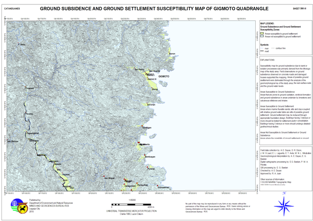
Catanduanes Geohazard Maps
Bagamanoc Quadrangle Flood Hazard Map Liquefaction Potential Map Landslide Susceptibility Map Ground Subsidence and Ground Settlement Susceptibility Map San Andres (Calolbon) Quadrangle Flood Hazard Map Liquefaction Potential Map Landslide Susceptibility Map Ground Subsidence and Ground Settlement Susceptibility Map Caramoran Quadrangle Flood Hazard Map Liquefaction Potential Map Landslide Susceptibility Map Ground Subsidence and Ground Settlement Susceptibility Map Gigmoto Quadrangle Flood Hazard Map Liquefaction Potential Map Landslide Susceptibility Map Ground Subsidence and Ground Settlement Susceptibility Map |
